

Autumn leaves at Devichoys Wood. Image by Ben Watkins
Ancient Woodland Inventory Update Project
What is the Ancient Woodland Inventory Update?
The Ancient Woodland Inventory (AWI) aims to identify woodland and wood pasture that has been continuously present for the last 400 years (since 1600). The existing Ancient Woodland Inventory was completed during the 1980s and 1990s, and was digitised to create a national dataset of ancient woodlands. However, these maps were completed before more sophisticated computer mapping was available and used a limited range of source material thus these provisional maps can be improved upon.
The AWI update aims to improve this existing inventory in both accuracy and extent, using GIS and new mapping software techniques not available at the time. Additionally, it will include smaller woodlands (minimum woodland size of 0.25ha) and wood pasture, and thus examine areas not previously investigated. The new update will also use a much wider range of sources and information to inform the inclusion of sites on the AWI, including old maps not previously digitised or accessible, but also species records, geological reports, satellite imagery and LiDAR data.
By detailing the location and distribution of ancient woods in Cornwall, these ecologically unique and historic sites can be protected and preserved.Ancient Woodland Inventory Officer

What is ancient woodland?
As defined by Natural England and the Forestry Commission, ancient woodland is an area that has been continuously wooded since at least 1600 AD and includes both:
- Ancient Semi-Natural Woodland (ASNW) - mainly made up of trees and shrubs native to the site, usually arising from natural regeneration
- Plantations on Ancient Woodland Sites (PAWS) - those areas that have been replanted with conifer or broadleaved trees that retain ancient woodland features
Ancient woodland does not have to consist only of ancient or even old trees, but the term indicates that the site has contained woodland since at least 1600 AD. Similarly, ‘continuously wooded’ does not mean that the whole site has had continuous tree cover, as both temporary and permanent open ground within woodland are important attributes of woods.
Visit Cabilla and Redrice Woods, a Cornwall Wildlife Trust nature reserve, to see one of Cornwall’s most beautiful and magical ancient woodlands

What is ancient wood pasture?
Ancient wood pasture is a distinct form of ancient woodland and is defined as an area that has been managed by a long-established tradition of grazing, often with at least some veteran or ancient trees or shrubs occurring in both small groups or as scattered individuals. Other semi-natural habitats including grassland, heathland and scrub may occur in a mosaic beneath the trees.
Wood pasture is often associated with parks and historic hunting grounds but can also be found in former commons and upland grazed areas.

Why are ancient woods so important?
Ancient woodlands hold a range of irreplaceable and unique ecological and cultural features and artefacts. Due to their age and biotic complexity, ancient woodlands are completely irreplaceable habitats that no management or replanting effort can replace.
The persistence of the woods, extending back at least 400 years, means that these habitats have developed unique communities of fungi, plants, insects and microorganisms. Ancient woodlands are the most complex terrestrial habitats in the UK. Woodlands are highly layered systems, involving complex soil systems, epiphytic groups, ground flora, shrub layers and of course the trees themselves. This multiplicity makes them incredibly rich in biodiversity.
As well as biological irreplaceability and uniqueness, ancient woods are woven into Britain’s cultural heritage. Woodland management for products and crafts are an important part of local history, and even if unpractised in woodlands for years, can still have an impact on the structure and function of woodlands centuries later. Ancient woods and particularly ancient and veteran trees are living history and reminders of our connections with the people, practices, culture and even language of the past. They are also peaceful and beautiful places, providing space to reconnect with nature, benefitting both physical and mental well-being.
Project outline
The project involves various phases of work in order to take steps further and further back in time, to determine whether woodlands present in Cornwall today were likely to be present in the 1600s (following the methodology outlined in the AWI update handbook). There is always a degree of uncertainty when using historical documents. However, using multiple historical sources, as well as ground-truthing, field evidence and local records all help inform the inventory.
Outlined below are the 4 phases of the project and the current progress being made.
Phase 1
The first phase involves taking one step back in time to the 1850s and comparing recent satellite data to very accurate maps made in the 1850s-60s. Due to high level of detail in the maps, they are an excellent source of information to start with, providing evidence for any current woodland being ‘long established’.
COMPLETED July 2022
Phase 2
The long-established woodland data from Phase 1 was then compared to the existing ancient woodland inventory, and any new sites flagged for further research
COMPLETED September 2022
Phase 3
Phase 3 is the largest stage of the project and involves analysing woodland sites not previously designated as ancient.
Each woodland will be individually assessed against multiple map sources, going as far back in time as is possible with the evidence available, to determine how old the woodland might be. For example, below are listed some of the sources being used:
- Epoch 1-4 maps
- Tithe Maps
- Ordnance Survey (OS) Old Series
- OS Drawings
- Thomas Martyn County Map
- Lanhydrock Maps
- Christopher Saxton Atlas of Cornwall
If there is not enough historical information accessible, more modern data will be assessed alongside field surveying, and ground truthing methods to help add to the evidence base.
IN PROGRESS - currently being undertaken within ERCCIS and the Cornwall Wildlife Trust.
Phase 4
Once the information has been gathered on each site, all the evidence will be appraised, and a decision is made on whether the woodland site should be included within the updated AWI.
IN PROGRESS - currently being undertaken within ERCCIS and the Cornwall Wildlife Trust.
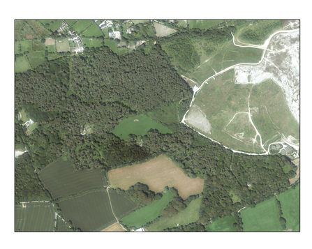
Historic and County Series Mapping (Cornwall Epoch 1 maps in ArcGIS Pro): ©Crown copyright and Landmark Information Group Ltd. All rights reserved 2021. Aerial Photography: ©Getmapping Plc and Bluesky International Limited 2021.
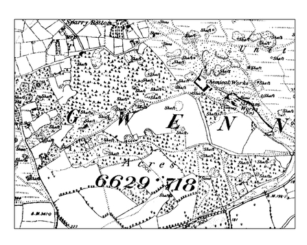
Historic and County Series Mapping (Cornwall Epoch 1 maps in ArcGIS Pro): ©Crown copyright and Landmark Information Group Ltd. All rights reserved 2021. Aerial Photography: ©Getmapping Plc and Bluesky International Limited 2021.
Images of the woods north of Gwennap (Gwennap parish, Cornwall) in both 2019 aerial imagery and in Epoch 1 County maps made between 1857 and 1884. These woods are not currently designated as ancient but need to be further investigated to find out when they might have established and therefore whether they might be ancient woodland.
How to help
There are over 6,000 sites to assess, and to properly investigate these woods we need lots of old maps and records. If you have any historic maps or records that show woodland land use (dated between 1600 and 1900) let us know, as these might help provide evidence for the age of important and unique woods in your area.
Or if you get a chance to wander around woodlands in Cornwall and have a feeling you are looking at ancient features do get in touch!
There are some very useful guides set up by the Woodland Trust (Ancient Woodland - British Habitats - Woodland Trust and How to Identify Ancient Woodland - Woodland Trust) that provide information on how to identify Ancient Woodlands from the ground.
This project is under contract from Natural England which is in partnership with the Woodland Trust.
If you would like to get in touch about the Ancient Woodland Inventory project, please email WIS@cornwallwildlifetrust.onmicrosoft.com.
To find out more please visit the ERCCIS website.
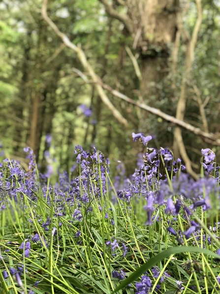
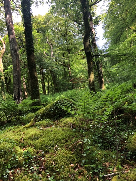
Images (C) Ingrid Easton
References
- Woodland Trust, Ancient Woodland, Ancient Woodland - British Habitats - Woodland Trust
- Woodland Trust, How to Identify Ancient Woodland, How to Identify Ancient Woodland - Woodland Trust
- Natural England, Ancient Woodland, ancient trees and veteran trees: advice for making planning decisions, Ancient woodland, ancient trees and veteran trees: advice for making planning decisions - GOV.UK (www.gov.uk)
- Natural England, Ancient Woodland Inventory Handbook for England, Ancient Woodland Inventory handbook - NECR248 (naturalengland.org.uk)
List of partner organisations